Trail of the First Wagons Over the Sierra Nevada (A Guide)
Charles Graydon
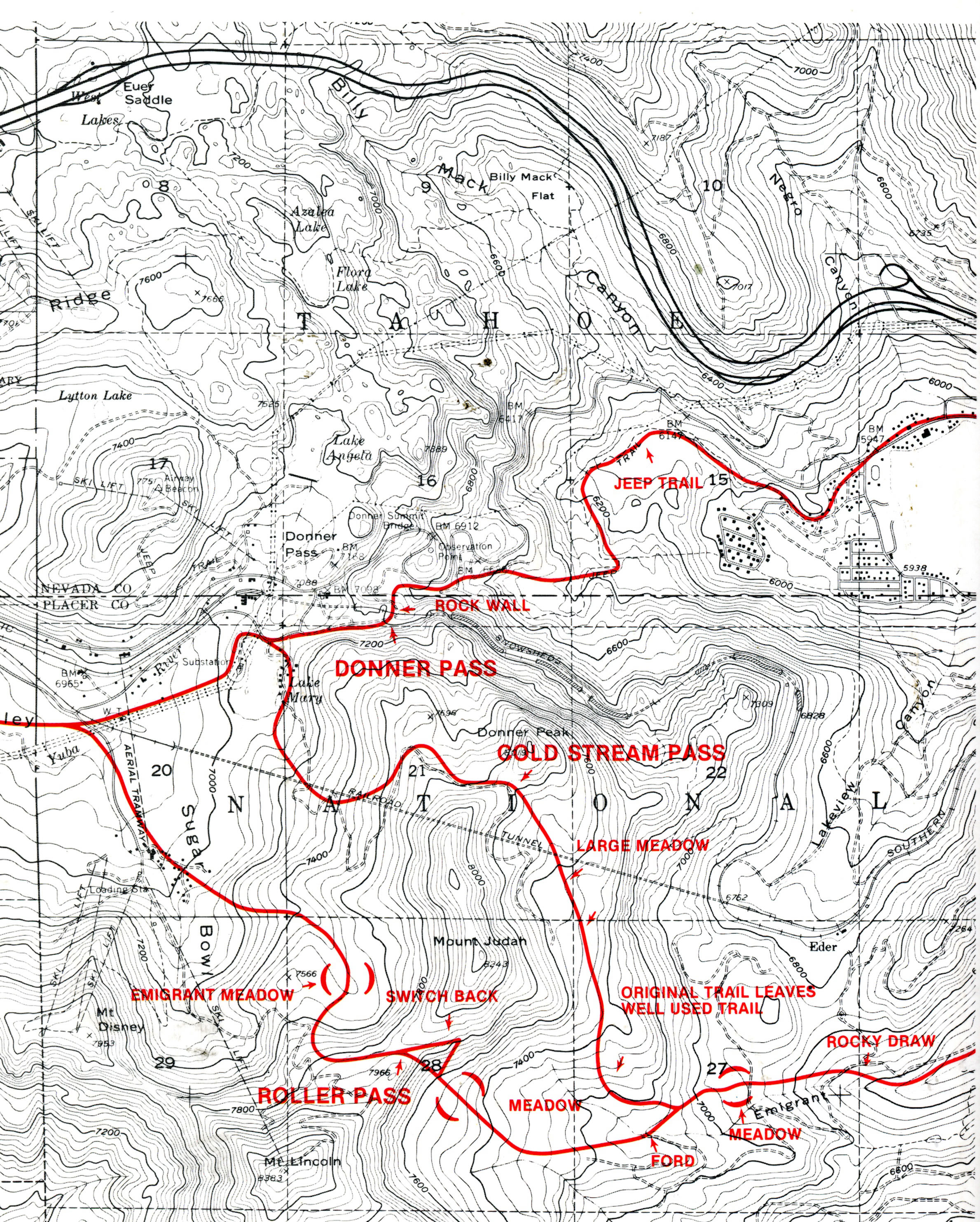
Most books are about the text and maybe some pictures. The purpose of this book is not the text, although there is some. The purpose of this book is the maps like the one below.
If you’ve always been curious about how the wagon trains got over Donner Summit to get to California because you’d like to vicariously enjoy the routes or if you’ve always wanted to explore the actual routes, then you will like the Trail of the First Wagons Over the Sierra Nevada. Charles Graydon has mapped every section of the trail starting at the Nevada State Line and going to Dutch Flat. Each map is accompanied by a short text which may include emigrant quotes and which explains that particular section of the route. You don’t use the book for the text though, although the directions are helfpul. You use it to see the actual routes.
Unfortunately in 1986 when Graydon wrote his book there was no GPS so there are no coodinates. If you are handy with topo maps though or know how to Graydon’s routes into your GPS device you will have no troubles following the portions of the route in which you are interested.
The map below shows the trails of wagon trains over Donner Summit: the original route in 1844 and 1845, the top red line; the Roller Pass Route, the lower red line; and the Coldstream route, after 1846, the middle red line.