Summit Valley - Sierra Jewel (map)
“Descending the rocky ravine a few miles, we emerged from it and entered a beautiful level valley, some four or five miles in length from east to west, and about two miles in breadth. A narrow, sluggish stream runs through this valley, the waters of which are of considerable depth, and the banks steep and miry. A luxuriant growth of grasses, of excellent quality, covered the entire valley with the richest verdure. Flowers were in bloom; and although late in August, the vegetation presented all the tenderness and freshness of May.”
That is how Edwin Bryant saw Summit Valley in his 1848 book, What I Saw in California.
Then Alonzo Delano some years later said, “....we reach the pleasant opening of Summit Valley, which lies nestled at the western base of the great wall and backbone of the Sierra Nevada. A charming glade... presents in summer an interesting contrast in its green bosom to the great wall of everlasting snow which rises on its eastern border, the apex of which is more than eight thousand feet.”
Donner Summit is the richest historical area in California and maybe the entire Western United States. Summit Valley is the richest part of Donner Summit. Native Americans occupied the valley for thousands of years. The first wagon trains to reach California with wagons came through Summit Valley as did the first transcontinental railroad, highway, telephone line, and air route (beacons sat around the valley). The rescuers of the Donner Party came through as did the first automobile, motorcycle and bicycle to cross the Sierra. There were hotels, stores, saloons, train stations, and stage stations. There are a myriad of stories to go with each of those.
Summit Valley is also the richest biological area of the summit with many different habitats hosting more than a hundred bird species, 116 species of butterflies, 16 amphibian species, dozens of mammal species, and loads of wildflowers. There is even a beaver living in the lake.
Summit Valley is indeed a jewel and with the purchase of Summit Valley by the Truckee Donner Land Trust in 2013, it is now open for public inspection and enjoyment. This menu will explore the richness of Summit Valley.
After you read, go visit.
Summit Valley Native Americans
 The first known residents of Summit Valley were the Martis, arriving about 2,000 B.C. They traveled in summers from both sides of the Sierra Crest to the high meadows following game and better summer climate. They first arrived just after the climate became wetter and game more plentiful. The change filled Lake Tahoe and caused it to overflow into the Truckee River.
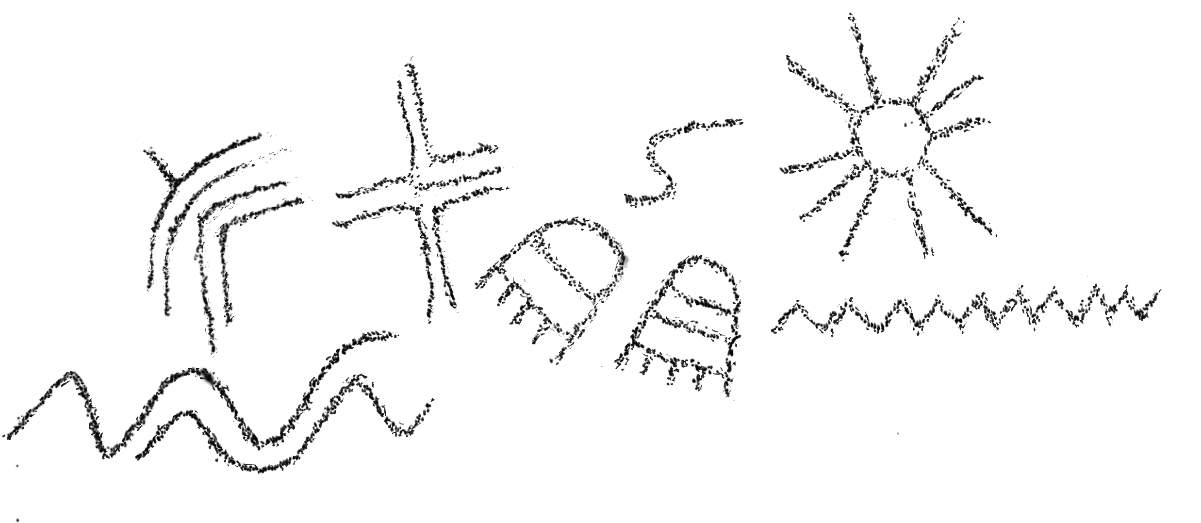
The Martis left evidence of their presence in many places on the Summit: petroglyphs (below left), mortars, metates, and basalt flakes left over from knapping projectile points (bottom right).
No one knows for sure from whom the Martis were descended or who their descendants are.
No one knows what became of the Martis either. The evidence of their occupation just stops about 500 A.D. That was also a time of more climate change.
Maybe more importantly, simultaneously, the bow and arrow came into use by the area’s Native Americans. The new weapon had more power, greater accuracy, and greater range. It must have changed hunting methods & the kinds of food that could be acquired. It may have changed culture. Maybe new prayers were needed. New skills were certainly needed. Maybe values changed.
The Martis stopped using Basalt for projectile points and adopted obsidian. Coincidentally, the closest obsidian source is the Yosemite area and it was just at that time that the Martis’ distinctive projectile style appeared there.
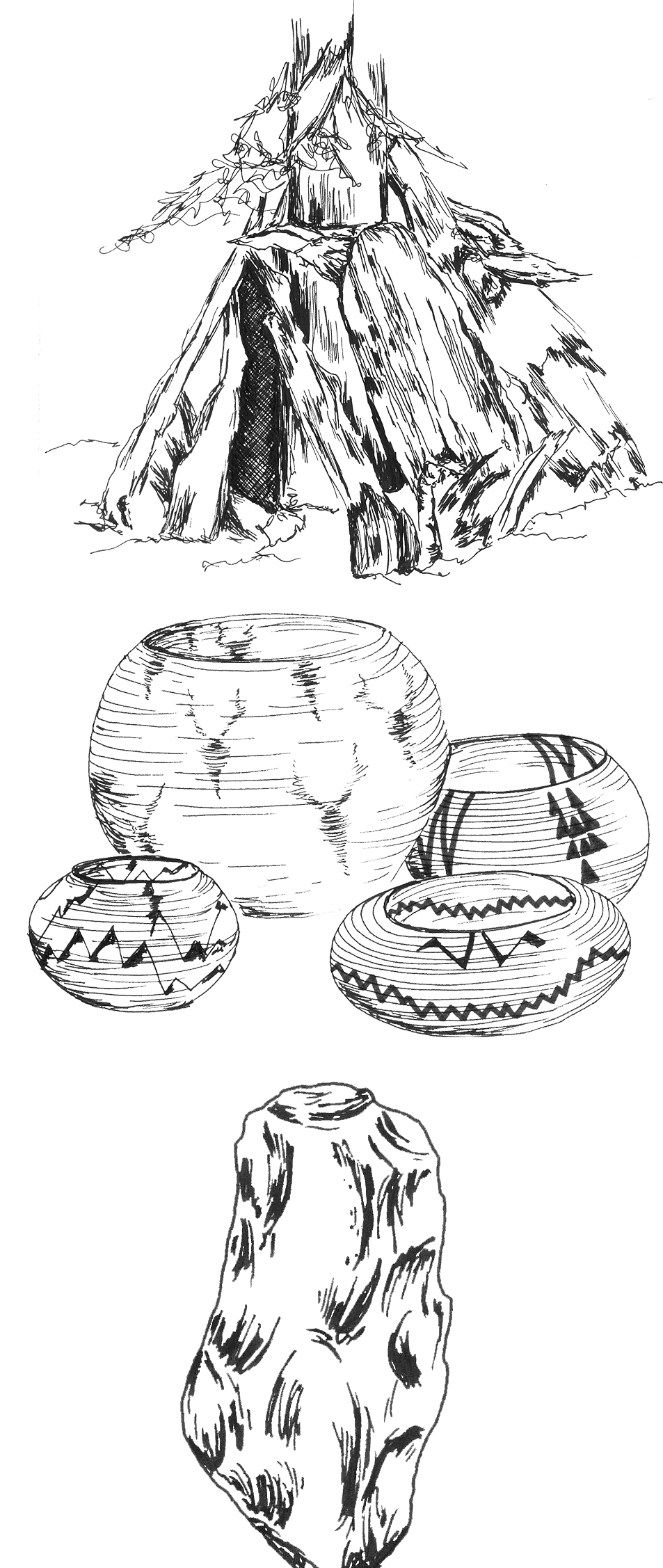
The Martis lived in houses built over depressions dug into the earth and covered with skins and bark like the one above right. They used water tight baskets, center right, to carry things. Heated rocks were placed into the baskets to cook.
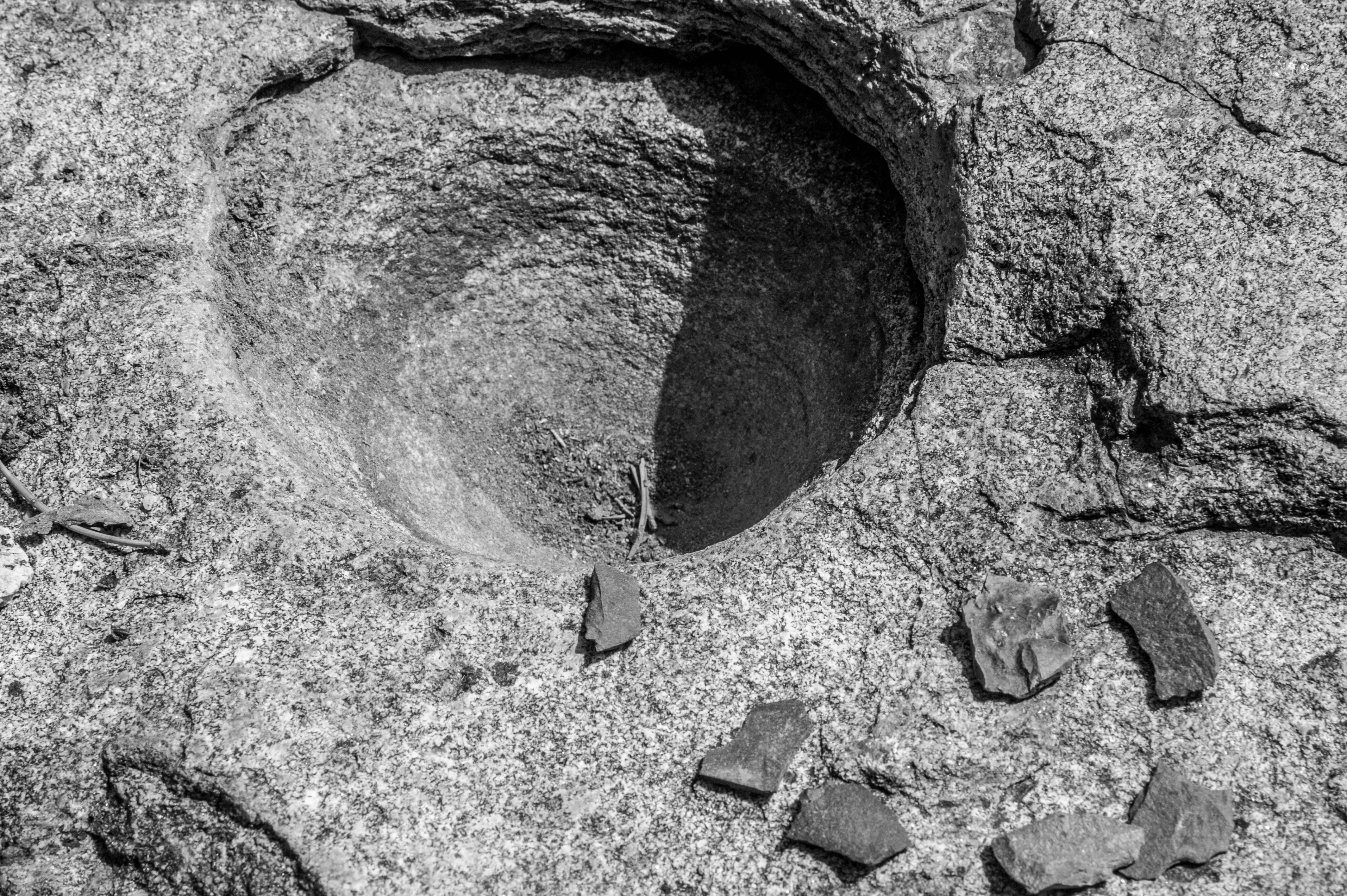
The Mortars and Metates
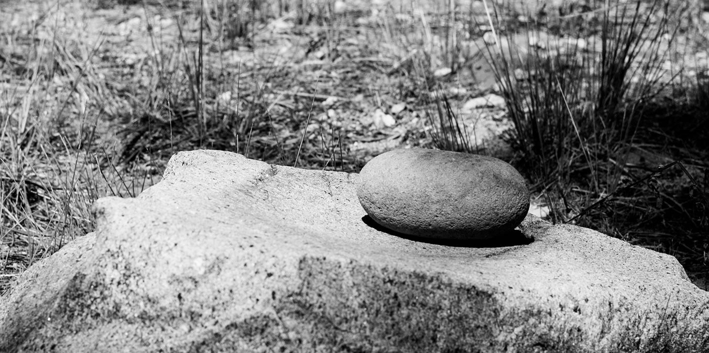 There is evidence of the Martis Culture’s presence in many places on Donner Summit and although the petroglyphs are maybe the most attractive, the mortars and metates are more impressive. There are dozens of mortar sites. Some have just one mortar (right) and others, many. There are also metates (top right), large grinding slicks. Manos, like the one sitting on the metate, were used to grind foodstuffs.
Both were used to grind seeds, insects, plant materials, nuts, and berries. Food is soft and the local granite is among the hardest rocks on earth.
Imagine how long it took to grind the depressions into the granite.
At the mortar sites women passed on important lessons to the young girls. Generation after generation little bits of culture passed on with each meal ground into the mortars.
Nearby the men and boys knapped basalt stone into projectile points They too passed on cultural knowledge to the boys, summer after summer, generation after generation, until the basalt discards littered the ground in thousands and thousands of pieces. Scattered around the mortar below are basalt flakes.
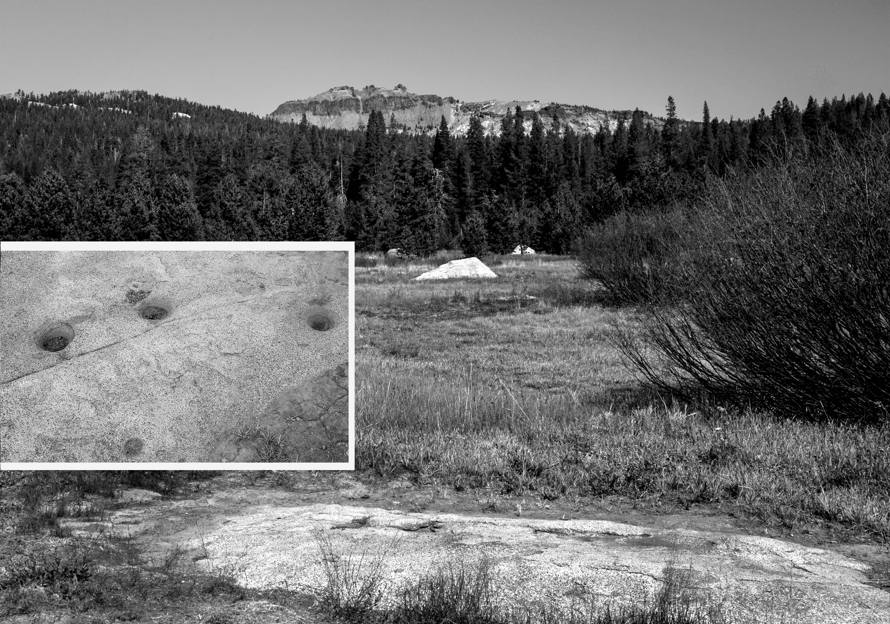 The rock in the lower part of the picture below must have been one of the most important to the Martis.
It is one of the few mortar sites not on the edge of the meadow. It has five mortar holes ground into as you can see in the inset. At the eastern end of the rock there is also a large metate. Many generations of women must have worked preparing meals around this rock, sharing stories, and passing on the culture to the young girls.
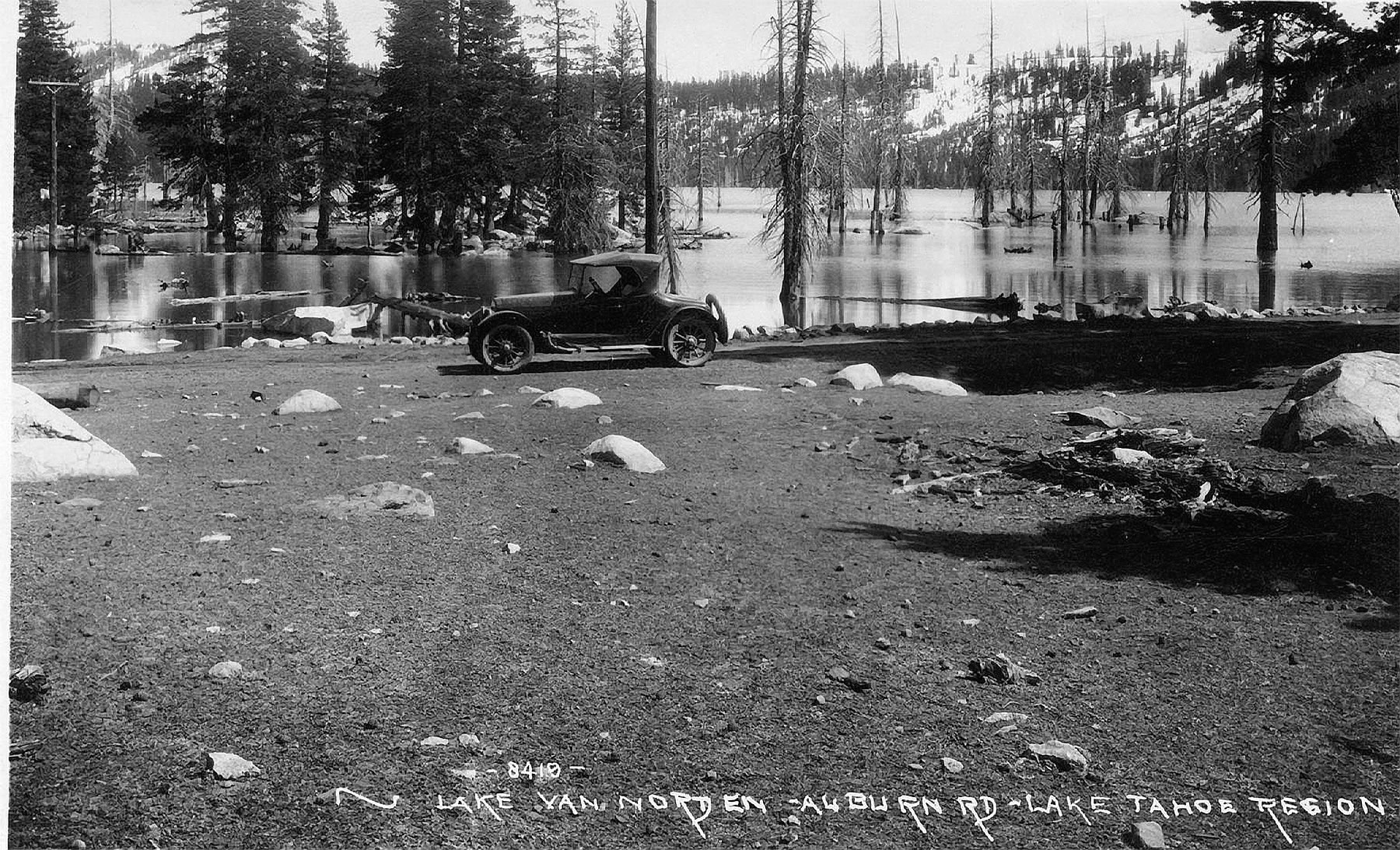
Van Norden Dam
 No one knows who first built the dam in Summit Valley but there was one as early as 1870 when a newspaper said there was “a big sandy dam across the valley, reared in a vain attempt to make an ice-pond.” Soda Springs in those days was, “an ugly group of whitewashed houses.”
The dam became part of the South Yuba Canal Co. which built canals and reservoirs first to supply hydraulic mining. Just as that was outlawed orchards were planted. The reservoirs and canals supplied irrigation to the fruit industry. Then electricity arrived and Van Norden Dam supplied the Drum Forebay power plant down the Yuba River. The South Yuba Canal Company became the Central California Electric Co. and then P G & E.
Each year the snowmelt would fill the lake and as the summer progressed and water in Sierra rivers and streams was reduced, water would be let out of the lake.
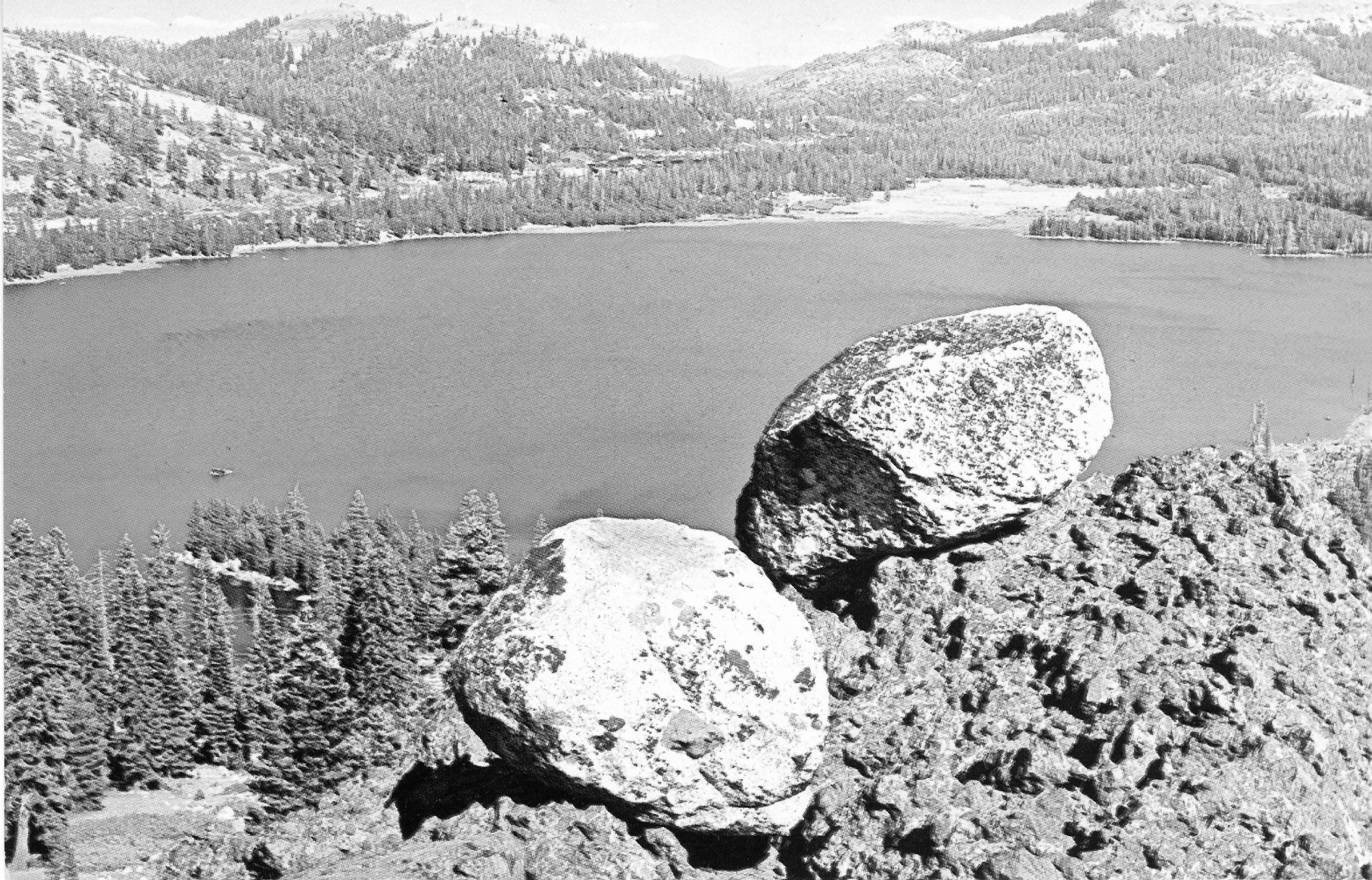
 Recreation was also a product of the dam. P G & E had a campground (right in the 1920's)along the Lincoln Highway and people used the lake for fun including water skiing. If you look very closely at the picture above rightyou might see a little dot just above the peninsula in the lower right. That was Norm Sayler’s water ski jump.
In 1971 it was discovered that the dam did not sit on bedrock and was built of uncompacted earth with a wooden core. If there was an earthquake 5800 acre feet of water could rush down the Yuba River washing away Soda Springs. P G & E considered rebuilding but the cost was prohibitive so they breached the dam. There would be no more water skiing on Lake Van Norden.
Summit Valley Views from the Old Days
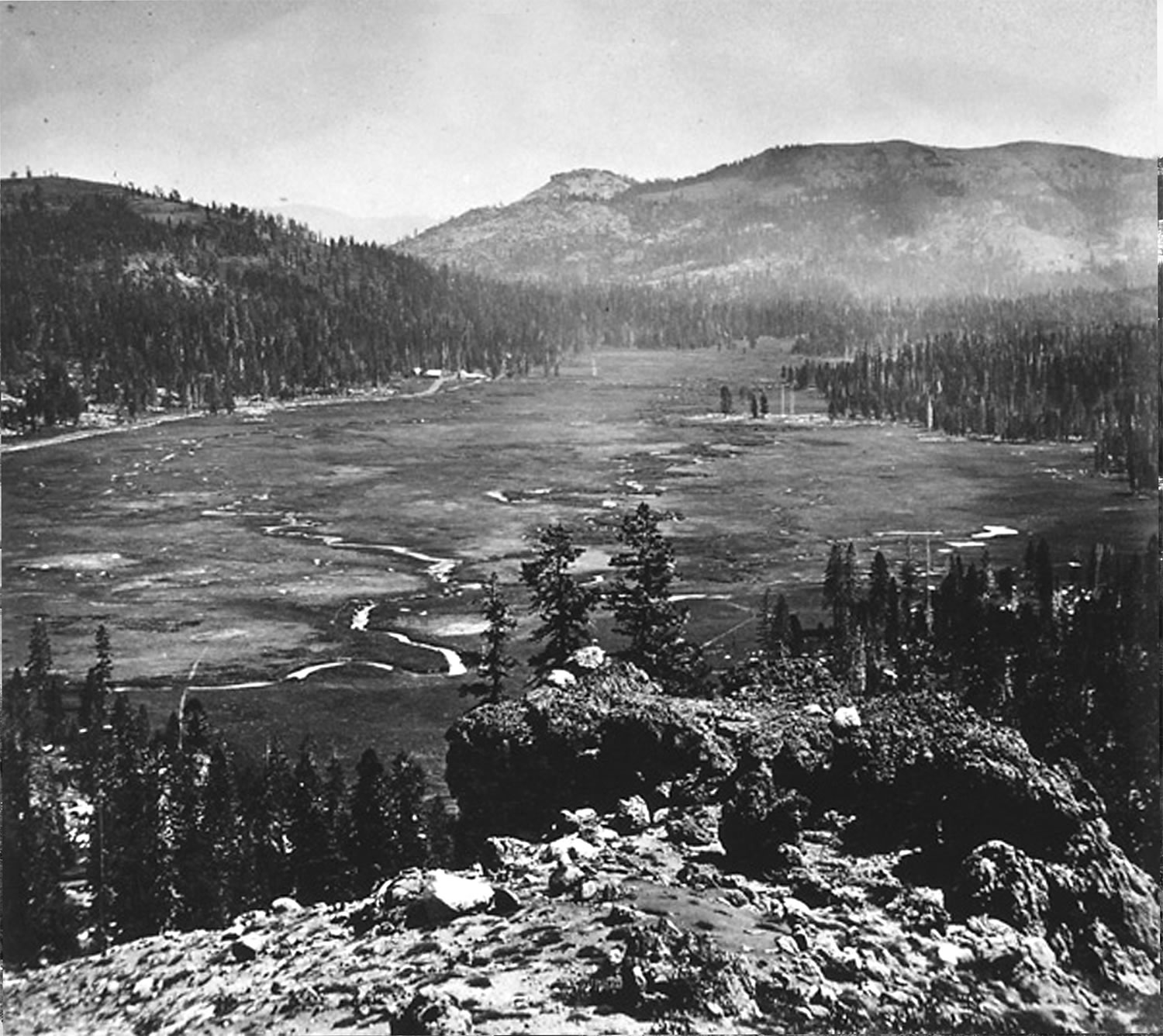 No sooner did the European Americans “discover” Summit Valley than they went to work “taming” it. They built roads, cabins, hotels, sawmills, an ice company, a railroad, and a dam. There were dairy cattle, an orchard, sheep, and stagecoaches. Right is Summit Valley about 1869, by Alfred A. Hart, railroad photographer.
The Dutch Flat Donner Lake Rd. saw so much activity that in 1867 85 train car loads of freight were unloaded per day at Cisco to be taken on wagons across the pass.
Once the railroad was finished to Truckee in 1868 traffic fell off and except for tourists to the Summit Hotel, the valley returned to a more peaceful existence.
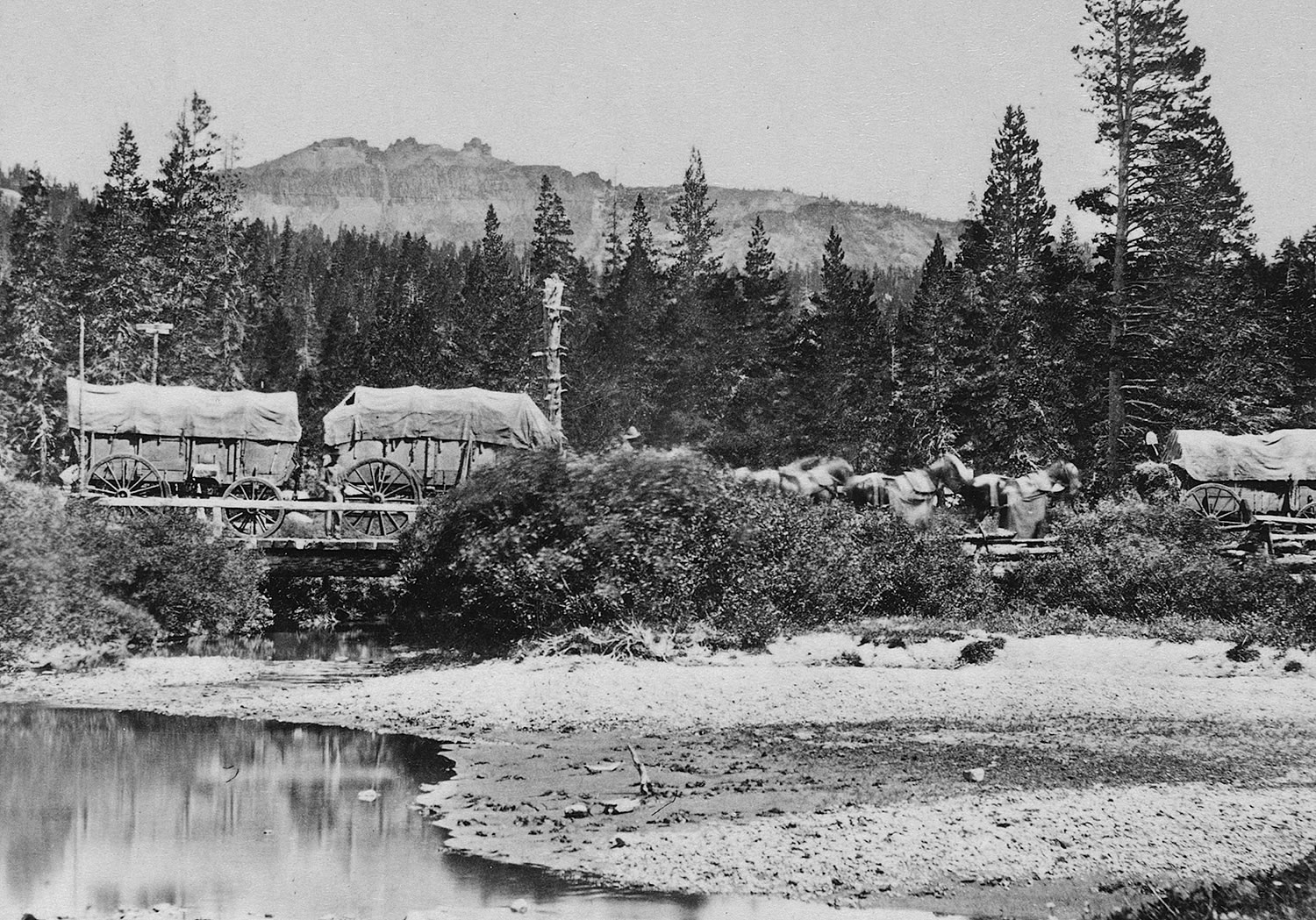 The photographs here are half of stereopticon slides (see below). The top is by Alfred A. Hart from what is now Soda Springs ski hill. The next two show wagons on the Dutch Flat Rd. where it crossed Castle Creek (see “A” on the map). You can still walk that stretch of the old road now that the lake is gone.
Below is a photograph of a freight wagon on the Dutch Flat Donner Lake Wagon Rd. about 1869. It's a Carleton Watkins photograph. He took over from Alfred A. Hart.
Summit Valley Sheep
 “The sound of bells when it was quiet was magical to hear.” The bells were on the lead sheep of the manyflocks that grazed Summit Valley. Soda Springs was a top sheep shipping center for a long time.
Mostly Basque sheepherders would start with their flocks in the Spring in the Central Valley and as the summer progressed they would move their ways up the Sierra canyons and rivers to the high mountain meadows. They arrived late in the summer for final fattening before getting on trains and trucks for their final journeys.
During the summer P G & E had been letting water out of Van Norden Dam to even out the flow in the Yuba River to the Drum Forebay power plant. As the water left, grass grew and was ready to nourish the sheep when they arrived.
There are still sheep pens and an old sheepherder’s shack in Summit Valley attesting to their presence and flocks of sheep still arrived in the valley as late as the 1970’s.
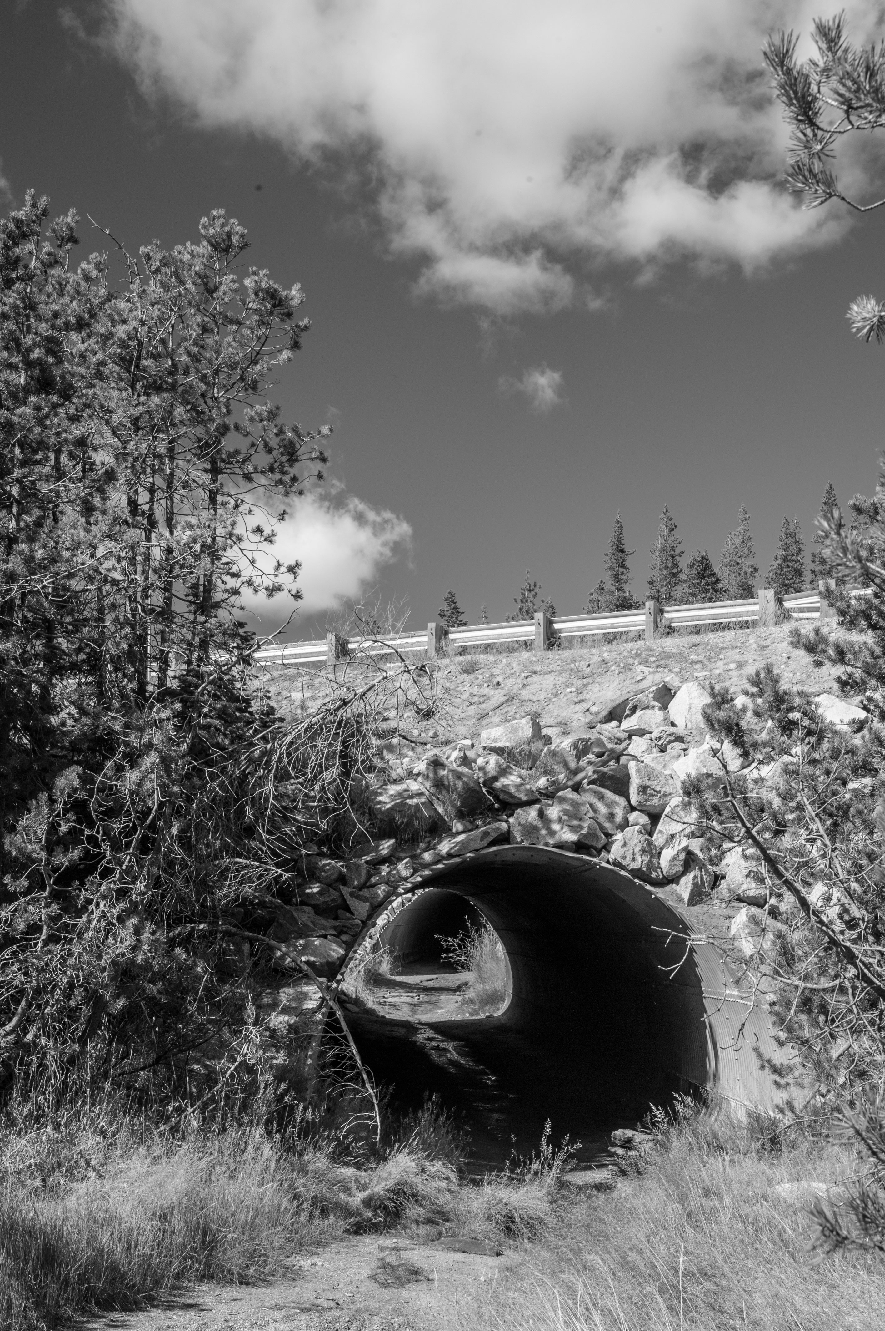
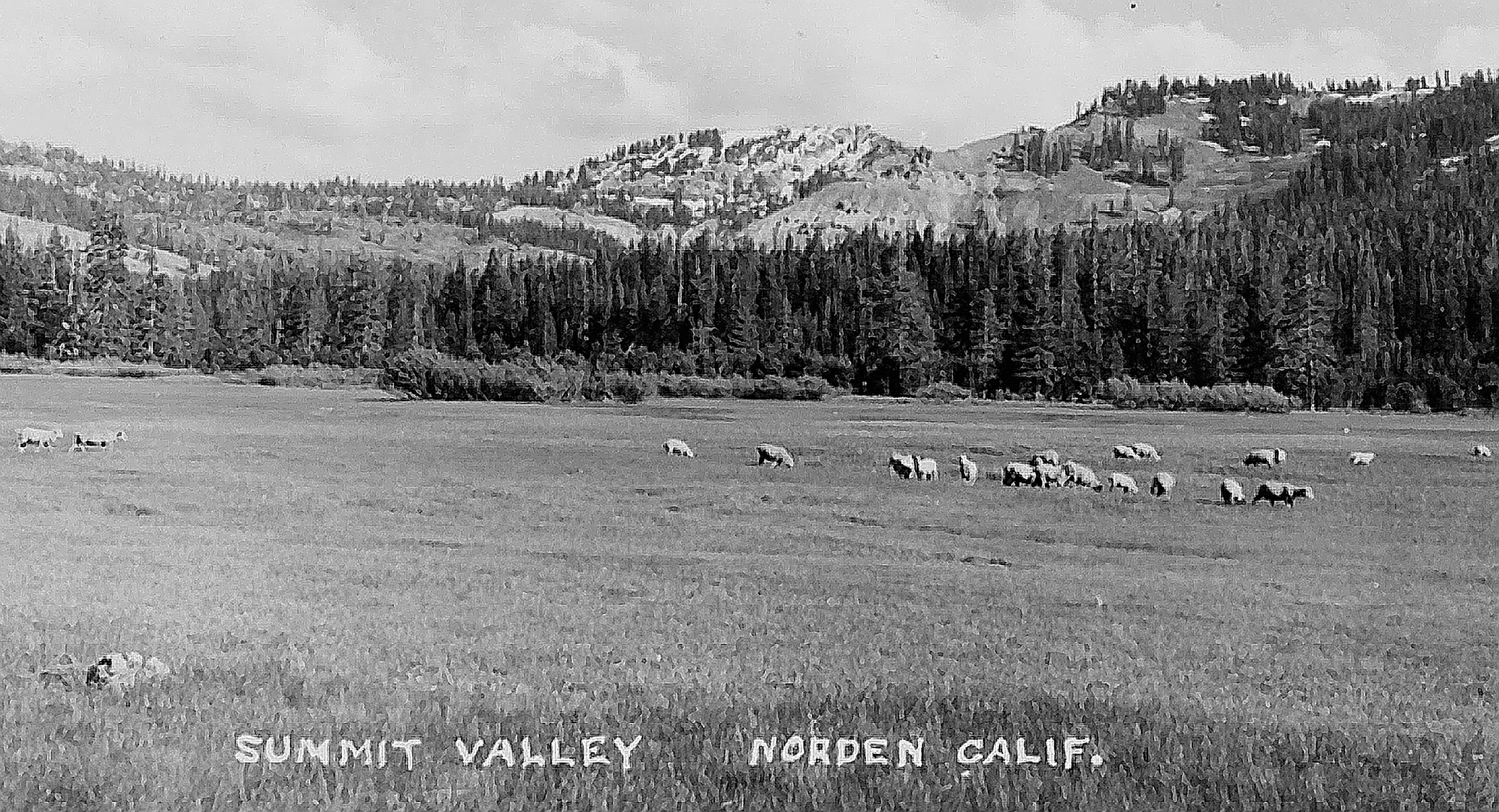
Old timers can still remember a time when the Basque sheepherders’ wagons dotted the valley along with their sheep. The photograph above is of the valley in 1956. Those are cows on the left. Below is a sheep underpass under I-80 on Donner Summit.