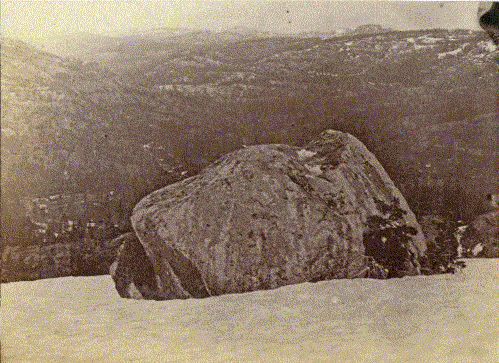
The twenty-foot granite block was left there when the glaciers receded. The top of Cisco Butte shows grooves from the glacier passing over it. Imagine the entire valley filled with ice, making its way west, and carrying rocks like this with it. Devil's Peak is visible in the upper right. This scene was later reprinted by Carleton Watkins in his "New Series." Photo location 39° 18.530'N 120° 33.733'W